Sunday, April 13, 2014

Field Activity #8: ArcPad Data Collection

Introduction:

The  purpose of this exercise will be to develop maps based on microclimate data collected from the surrounding UW- Eau Claire campus. This data was collected by several different teams of students and pooled in order to build maps with a larger scope of the campus.

A microclimate is used to note the climatic changes of a relatively small area. But even within a small area man-made and geomorphic features cause variations in weather variables.

A gallery of weather variables was developed and built into domains and exported to our Trimble Juno GPS unit in a previous exercise. Now, measurements for these variables will be recorded on a mobile weather station/GPS unit to connect them with spatial locations. Once collected, this data will be transferred to ArcMap where various maps can be produced in order to display the weather variables and variations within our microclimate (the UWEC campus).

Methods:

Data Collection

The Trimble GPS Unit (as seen in Figure 1) containing the domains for our weather variables was use to record measurements and notes based on our field observations. Because each variable is measured in different units, this unit, equipped with pre-set units for each field, allowed us to move as quickly as possible from point to point.


Figure 1: This visual displays a Trimble Juno GPS unit used for collecting field data.
 

A Kestrel Mobile weather station (as seen in Figure 2) allowed us to collect weather observation data such as wind speed, temperature, dew point and relative humidity.


Figure 2: This visual displays a Kestrel Mobile Weather Station for collecting weather variable data
 
 
In addition a meter stick was used to record snow depth, and a compass was used to approximate wind direction.

Data Transfer

After data collection, the data from each team with their various points and microclimate data were merged into one feature class (as seen in Figure 3). While this would ideally be a very easy problem, we hit a snag at this point of the exercise because we had failed to coordinate our attribute table headings.

Figure 3: This map shows the collected point from each team combined into one feature class

Within the merge tool, a field map was used to categorize the different input headings that recorded the same category of data from each group. This made it possible to combine them into one output. To avoid error, we merged the data from one group at a time. This allowed us to avoid the confusion of trying to assure every category was matched properly for seven groups at once.

From there, it was possible to develop maps using interpolation methods offered through ArcMap to
effectively display the data. These methods include spline, kriging and inverse distance weighted (IDW) among others. An entire suite of interpolation methods and their explanations allow users to experiment with and understand the best usages for these methods.

One other problem arose when a few data points were actually locate near the Equator. These points were simply deleted allowing raster design to proceed.


Results/Discussion:


Temperature Map

First, I produced a map of temperature data (as seen in Figure 4). I did not find the original results of the IDW interpolation for temperature to be particularly illuminating. In an effort to try to produce something better, I manually adjusted the class breaks. I chose to use a lot of classes because there really isn't that much differentiation between most of the temperature data outside of a few outliers. This way, I wouldn't be overstating the temperature difference around campus. I am happy that temperatures under 32 degrees stayed in the relatively blue classes on the map. It might seem like an aberration to have values between 45 and 80 degrees when most other values are hovering around 32 degrees. This was due to temperature recording at a point directly beneath a heat vent.

 
Figure 4: This map shows the temperature variation recorded on the UWEC campus
 

Wind Speed and Direction Map

The next variables I interpolated were wind speed and direction (as seen in Figure 5). Using the IDW interpolation on wind speed, I again adjusted the class breaks and applied a single color scheme to help identify where wind speed is increasing more easily.. The trick of this map was how to allow readers to ascertain both variables at the same time. I wanted to indicate the direction of the wind while still allowing them to see the wind speed beneath. I chose to symbolize wind direction with a hollow arrow and adjusted the direction of the arrow based on the direction in the symbolization menu.

I almost made the huge mistake of not pointing my arrows the way the wind is heading which is exactly opposite of what you record when determining wind direction. Luckily, I caught my blunder and made the adjustment. Initially, I wanted to only include one arrow in my legend to avoid redundancy, but after experiencing my own oversight, I realized there might be poepl who would benefit from seeing the arrow associated with each direction.

Obviously buildings wreak havoc with a consistent wind direction flow as can be seen by the arrows pointing in various directions between buildings. I was also intrigued by the wind tunnel seemingly create in the campus mall area.


Figure 5: This map displays the wind speed and direction measurements recorded across the UWEC campus.
 

Snow Depth Map

Displaying snow depth (as seen in Figure 6) may be a little bit sketchy. Without far more measurements than we were able to take, it will be almost impossible to get a clear picture of the snow depth panorama in a built environment. With heavy snows and plowed paths varying constantly in every direction, if the points collected are not tight and regular, the interpolation will attribute smoothing that really shouldn't be there. But, there really weren't enough points taken to just indicate snow depth at each point alone, either. Clearly there are no massive snow drifts in the middle of the Chippew River or literally piled on top of buidlings. Snow depth recordings in a built environment require far more precision than we were shooting for with this exercise.

 
Figure 6: This map displays snow depth based on measurements taken on the UWEC campus
 

Relative Humidity Map

Relative Humidity refers to the amount of moisture in the air. While this is certainly not my area of expertise. The pattern of low relative humidity in most parking lots catches my eye (as seen in Figure7) . I am very intrigued by the high relative humidity on the back-end of Phillips Hall, though I cannot say why this might be unless the data in this area was recorded on a day that was very different from when all of the other data was recorded.

 
Figure 7: This map displays relative humidity data based on measurements taken on the UWEC campus
 
 
Dew Point
 
Lastly a map of dew points was made (as seen in Figure 8). This is another measure of moisture in the air where the closer the dew point value is to the recorded temperature the more moisture is in the air. Most noticeable here is the high dewpoints recorded on the far bank of the Chippewa River.
 
 
Figure 8: This map displays dew point data based on measurements recorded on the UWEC campus


Conclusion:

This exercise is really invaluable from start to finish. I realize how much you aren't thinking of in pre-planning when it comes to how you will record data and potential problems you may face. That is why Dr. Hupy has stressed the taking of notes whenever you are in the field. For whatever reason, he notes field was not in working order. However, this should not have kept us from recording notes. It is essential to accurate data collection.

Also, the snow depth measurements was an eye-opener for me. It is important to consider the environment around and envision how data recording will work for a particular variable. With some forethought, it could have been determined how often we would need to record this in order to produce a valuable map. The data we recorded is insufficient to produce a map document worth its weight in paper.


Sunday, March 16, 2014

Field Activity #7: Visual Introduction to Unmanned Aerial Vehicles

Introduction:

In this field activity, I was given the opportunity to see a few different unmanned aerial vehicles in action. While the term seems to imply something very mechanical, in reality it can be something as simple as a kite. Four different methods were experimented with including two rotary wing aircraft as well as a kite and a rocket. 

Methods:

Rotary Wing Aircraft #1

The first UAV (seen in Figure 1) belonged to Dr. Joe Hupy. As you can see it hovers using the the three double-blade propellers. This is field undergoing a lot of experimentation with different methods. Thus, this is not the only model by any means.

Figure 1: This rotary wing UAV belonging to Dr. Joe Hupy hovers utilizing three double-blade propellors. 

Just to give you an idea of the technology involved, this rotary wing aircraft is powered by a battery. It also needs to carry a sensor (or multiple sensors depending on the needs of the operation). This craft is equipped with a canon digital camera as well as various other sensors (as seen in Figure 2). Payload is very important for each UAV because the aircraft will need to be able to carry the weight of all necessary sensors and so forth and still maintain flight per operation specifications. This requires careful pre-planning to assess these needs, develop an appropriate UAV, and arm it with the necessary devices.

Figure 2: This figure shows the battery and sensors attached to the UAV comprising its payload.

It is also important to have experiencing operating a UAV when doing field work. This rotary wing aircraft is controlled by a remote control (as seen in Figure 3). Without knowing how to handle the aircraft under its current specifications, it could be lost altogether. Each time payload is adjusted, the aircraft will need to adjust as well. Very few (if any) parts of using UAVs can be done haphazardly. This aircraft experienced a payload change and had to undergo in-flight calibration to assess the capability for the craft to manage the weight and get the weight properly balanced for accurate flight guidance by an operator.

Figure 3: This figure shows the remote control used to operate and guide the rotary wing aircraft.

Figure 4: This figure shows an operator using a remote control guiding the rotary wing aircraft

Just to give you an idea of what this aircraft looks like in flight I have included a video (as seen in Figure 4). I have to admit, it is a little bit unnerving to see something like this if you are not aware of who is operating it and for what purpose. These are items to take not of when undertaking a mission using a UAV.


Figure 4: This figure shows Dr. Hupy's rotary wing aircraft in flight.

Rotary Wing Aircraft #2

The second UAV we witnessed in action was also a rotary wing aircraft. This model was developed by the operator (seen with his aircraft in Figure 5). As opposed to the first one, it hovers utilizing 6 single-blade propellers.

Figure 5: This figure shows a rotary wing aircraft with its creator in the background. It hovers using 6 single-blade propellers.

This particular model was much faster than the first rotary wing aircraft (as seen in Figure 6). Both of them had approximately the same amount of flight time. 


Figure 6: This figure shows the take-off for the rotary wing aircraft. 

Kite

Next, a kite was put up into the air. This is not a cheap kite you buy at Wal-Mart. It is basically industrial strength (for a kite) in order to withstand conditions as well as handle a payload in order to carry a sensor.

Figure 7: This figure shows the kite that operates as a UAV by being armed with a sensor.

Once the kite is in flight, a sensor is basically run up the string (as seen in Figure 8) in order to capture aerial footage.

Figure 8: This figure shows a sensor being run up the string of the kite in order to capture aerial footage.

This may seem a rudimentary method of capturing aerial footage, but it can be highly effective in the right setting. Wind is obviously the most crucial factor to monitor if this method is used. Without enough wind, your operation will be grounded. Too much wind can also be an adverse factor.

Figure 9: This figure shows the kite attached with an aerial sensor in flight.

Rocket

As I mentioned, in this fledgling industry a lot of experimentation exists. this is especially true as each new mission presents unique nuances that need to be addressed. Dr. Joe Hupy had the idea of attaching a small sensor to a rocket (as seen in Figure 10. This would be a relatively inexpensive option to obtain aerial footage if it works. 

As you can imagine, the element of control seen in both kite and rotary wing aircraft flights is not really an option with this method. Its used would be minimal, but with a small mission scope, could prove extremely useful. 
Figure 10: This figure shows Dr. Joe Hupy attaching a small sensor to a rocket for the purpose of colleecting aerial footage.

Unfortunately this trial did not work out. Both engines in the rocket did not fire properly and the flight time was very short lived. This is the nature of experimentation, and it will be be carried out again. 

Conclusion:

There are many methods by which aerial images can be obtained. This exercise was just an example of some them. Each method presents unique capabilities and challenges that must be accounted for in mission planning.


Sunday, March 9, 2014

Field Activity #6: Microclimate Geodatabase Construction for Deployment to ArcPad

Introduction:

It is very important to establish and understand the relationship between field work and ArcGIS. Properly utilized, ArcGIS can enhance the work being done in the field; failing to utilize ArcGIS properly can actually create more difficulty in the collection and transmission of data captured in the field.

The basis for a good relationship between ArcGIS and field work can be condensed down to pre-planning. Taking the time to develop the needs of your project and mold ArcGIS tools around those needs is essential to efficient and accurate data collection.

One of the keys to building this relationship is geodatabase construction. In preparation for the creation of a microclimate map of the UWEC campus, this exercise will focus in building a properly formatted geodatabase considering all the variables associated with the project. After providing some general information about a geodatabase, I will go over each of these two elements, pre-planning and geodatabase construction, in detail.

Geodatabase Overview:

When importing spatial and attribute data into ArcMAP, it must be "contained" in something that the program can read and display.

Two different formats exist to do this: geodatabases and shapefiles.

Shapefiles (.shp) were originally created in the 1990's for use with the original ESRI program called ArcView. They store the primitive geometric data types of points, lines, and polygons. However this format lacks the capacity to store topological information. In other words, they do not possess the ability for the user to specify rules and conditions pertaining to the data. Pertaining to field work, this makes it much more time consuming for an operator to monitor the data collection process in order to avoid errors. As a general rule, shapefiles are larger, slower and less flexible than file geodatabases.

Geodatabases (.gdb), store the same type of information found in shapefiles as feature classes and can contain many such classes. In addition to being smaller, faster, and more flexible, geodatabases have one major advantage over shapefiles, the ability to utilize data management capabilities offered in ArcMAP. Topological information (rules) can be applied to the geodatabase, and each feature class within it, based on the range and type information they will contain.

This acts as a management tool for data being captured in the field. For instance, if the range of a particular type of data is well known, the range can be applied to a feature class essentially disallowing numbers outside of this range. This can help to avoid data entry mistakes while doing field work.

Five reasons to use geodatabases have been outlined by ESRI as listed below:
  1. A geodatabase is a uniform repository for geographic data, and it is scalable. This makes it easier to manage and access.
  2. Data entry and editing are more efficient. By storing GID data in a geodatabase, you are able to apply rules and constraints on the GIS data to reduce the chances of error being introduced into the datasets.
  3. The geodatabase can model advanced spatial relationships. The geodatabase not only defines how data is stored, accessed, and managed, but it can also implement and model spatial relationships of features in a feature class or between feature classes.
  4. The geodatabase has multiuser capabilities. You can have two or more users accessing the data at the same time, simultaneously making edits.
  5. The geodatabase enables your GIS data to be integrated with information technology systems.

Pre-Planning:

Because of the advantages offered through the use of a geodatabase, they are an invaluable tool for fieldwork if properly employed. This is entirely contingent upon careful pre-planning by operators. Careful analysis should take place defining the scope of all data pertaining to the mission.

To guide thinking for the pre-planning process as it pertains to geodatabases, think in terms of domains, ranges, and measurement units.

These are the categories used in ArcMAP for geodatabase creation and will be discussed further in the next section, Geodatabase Construction. For now, just think of a domain as the general kind of data being collected (tree diameter, hill slope, wind direction, etc.), and ranges as the bounds that can be applied wherein all data collected will fall. Measurement units should be much simpler to understand, still it is important to specify how your data is being measured. Is distance being measured in meters or feet?

While this is not an exhaustive list of questions to be asked, the following can act as a guide for how to engage in pre-planning for the purpose of constructing an effective geodatabase.
What are the variables (domains) pertaining to your mission?
Can the data collection of these variables be bounded into a range of possible entries?
What are the measurement units for each variable?
If the variable records nominal data can it be grouped into categories?

Specifying the answers to these questions will provide you with the information you need to build an effective geodatabase.

Microclimate Pre-Planning Example

To provide an idea of how pre-planning for a geodatabase should be carried out. I will answer the questions I have listed and provide answers pertaining to the microclimate geodatabase I am preparing for use in a future exercise.

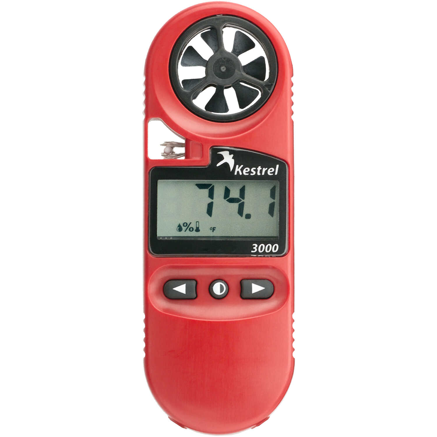
In the following weeks, I will be building a microclimate map of the UWEC campus. This will be done by measuring designated variables at various locations on campus and entering their records into a GPS device. In order to ensure accurate and efficient data collection, I will build a geodatabase with my specified domains and fields. This information will be imported to the GIS device. I will then be able to enter my data into pre-assigned fields based on my planning. 

What are the variables (domains) pertaining to your mission?

Because my mission will be to create a microclimate map, I will be identifying weather-related variables to be entered as domains.

The variables I have identified are group name or number, temperature, time of day, wind direction, wind speed, relative humidity, dewpoint, and snow depth. 

*It is also a good idea to include a general notes field for any information that does not fall into your variable categories.*

Can the data collection of these variables be bounded into a range of possible entries?/

What are the measurement units for each variable?/

 If the variable records nominal data can it be grouped into categories?

A common sense approach can help guide you to identify the ranges, numerical units, and categories for your variables. You want to allow for data that may not fit your initial expectations while disallowing numbers that are clearly outside of the range of possibility. For instance, temperature in Eau Claire in January and February have been extremely cold. However, it is not out of the realm of possibility to see temperatures much warmer than expected. I want to comfortably set my range to encompass the entire realm of possible outcomes and exclude such possibilities as 150 degrees Fahrenheit.

Some data may not be numbers but nominal data. For instance, wind direction data will not be entered as a number but in words like northeast or southwest. Other information for other studies may be categorical in nature such as identifying how many of a certain kind of tree are in a certain area. Then, you would want to establish the potential range of categories. In Eau Claire, WI desert cacti can be ruled out as a potential category.

Once you have identified these elements pertaining to the data for your mission, you can proceed to building a geodatabase. I will explain this process in the next section.

Geodatabase Construction:

Any time you are working with a new tool, becoming familiar with terminology, definitions, and locations can often be an arduous process. Building a geodatabase is a relatively simple process once you have become familiar with the basics. If it seems difficult at first, it is most likely just a matter of allowing yourself time to acclimate to what you are doing.
First, the program in which to set up a geodatabase is ArcCatalog. Open this program to begin.
Create a New File Geodatabase

Step 1: Within the catalog tree to the left of the screen, right click on the folder connection you would like to store the new geodatabase in. Select New and File Geodatabase (as seen in Figure 1).


Figure 1: This figure outlines the steps in ArcCatalog to take in order to create a new geodatabase.

Step 2: You will then have the opportunity to name your geodatabase (as seen in the highlighted area in figure 2). As a general rule avoid long names and spaces. In order to create space between two items, use underscore instead.

Figure 2: This figure shows the area where you can enter the name of your geodatabase (as seen in the highlighted area).

 Add Domains from Pre-Planning

Step 3: Next, you want to enter the domains you defined in your pre-planning as well as specify ranges and units of measurement for each domain. To do this, first right click on your newly created geodatabase, and select properties.


Figure 3: This figure shows you how to select Properties in order to be able to enter your domains from pre-planning.

Step 4:The Database Properties screen will appear (as seen in Figure 4). Select the Domains tab at the top-left of this screen and you will be able to enter your domains.

Figure 4: This figure shows the layout of the Database Properties screen. This is where you will enter your domain information.

Step 5: To begin entering your domains start in the Domain Name field. Here you want to include a general title based on the variable. The Description area can include any information that helps you define the variable. Think of what you might want to remember when you are collecting data. For instance, I am not used to thinking in military time when recording the time. I will be setting the range up in way where military time is required. To ensure I remember that in the field, I have included that information in the description (as seen in Figure 5).

Figure 5: This figure shows the domain names and descriptions entered for the microclimate geodatabase. The domain name is the general description of the variable; the description can contain any information pertinent to you in the field.

Step 6: Next, move down the screen in the same database properties window to choose your Field Types. This exact term has not been previously mentioned but pertains to both the range and measurement unit specifications developed in pre-planning. 

When you click on the default setting, text, to the right of Field Type, a drop-down menu will appear containing the following seven options: short integer, long integer, float, double, text, and date. Four of them relate to specific types of numerical data. Examples and applications pertaining to each data type are available from ESRI (as seen in Figure 6).

Figure 7: This table from ESRI outlines the range of usage for the four numeric data types.

Two data types are not included in this table because they are not for numerical data. I will explain their uses below.

Date: This data type is self-explanatory. However, it can include dates, times or dates AND times. The default setting for this data type consists of mm/dd/yy and hh:mm:ss fields for date and time, respectively.

Text: While this may also seem self-explanatory, the text field can include both letters AND numbers for use in recording street names, etc. It can be used for any variable not identified with numeric values. 

Another option is to "code" textual information with numeric values to save storage space in the geodatabase. In order to take this step, pre-planning must include setting up an accurate coded system.  

Step 7: If you have specified any ranges to bond your data by, you can do this by selecting the field to the right of Domain Type. A drop-down menu will allow you to select either coded values or range. Coded values is the default setting. By choosing range, a space for Minimum Value and Maximum Value becomes available (as seen in Figure 8).

Figure 8: This figure shows the minimum and maximum value field appearing below domain type when the domain type is switched to range.

Step 8: If you have chosen to included coded values for any of your domains you can enter them at the bottom of the database properties screen in the coded values table. Make sure the appropriate domain name is active when you do this or you could apply it to the wrong domain. In the Code field, specify the number attached to a certain value or category. Under the Description heading, specify the exact values attached to the code (as seen in Figure 9).

Figure 9: At the bottom of this figure entries for coded values can be seen including the code and description.

Step 9: You now have completed all the step necessary for the creation of your geodatabase. Simply select Apply at the bottom right of the Database Properties. 

Create a Feature Class in ArcCatalog

As mentioned in the Geodatabase Overview, geodatabases store data in feature classes. Information is added to a map by adding feature classes to the geodatabase. You will need to create a new feature class.

Step 1: Right click on your new geodatabase; navigate to New, and Feature Class (as seen in Figure 10). 

Figure 10: This figure outlines the process of creating a new feature class within your database in ArcCatalog.

Step 2: A window will appear allowing you to name your new feature class as well as set the Type of features you would like to be stored in the feature class in the drop down menu (as seen in Figure 11). The type of features you choose should be based on the way your data will be displayed on a map. If you will simply be storing point data, choose point features, if you are outlining building locations and basic area, choose polygon features, etc.

Figure 11: This figure shows the New Feature Class screen. Here you will enter the name of your feature class as well as set the feature type from the drop-down menu under Type.

Once this has been completed select Next at the bottom-right of the New Feature Class window.

Step 3: The next screen that will appear allows you to choose a coordinate system in which to display your data when you are ready to map (as seen in Figure 12). It is very important to choose a coordinate system that displays your particular area the best way possible. The UWEC campus is located in Eau Claire, WI will be best viewed in the NAD 1983 UTM Zone 15N and will be used to display my microclimate map.

Figure 12: this figure shows the screen where you will select the coordinate system to display your new feature class. More details about the coordinate system you select are listed under Current Coordinate System at the bottom of the screen.

Once you have selected your coordinate system, choose Next at the bottom-right of the Feature Class Properties window.

Step 4:  The next screen will allow you to adjust the XY tolerance if you so desire. For this exercise, no changes were needed. To move from this step, select Next at the bottom-right of the Feature Class Properties window.

Step 5: The next screen will allow you to specify the database storage configuration. In most cases, you will choose the Default setting. To move from this step, select Next at the bottom-right of the Feature Class Properties window.

Step 6: The next screen to appear will have headings of Field Name and Data Type at the top (as seen in Figure 13). Underneath these headings you will place your Domain categories and their coinciding data types.

Figure 13: This figure shows the table where you will enter the domains and data types specified when you created your geodatabase based on your pre-planning.

When you have entered all of your domains and field types, click Finish at the bottom right of the New Feature Class Window. This new feature class will be used, through ArcPad, on the GPS unit to record data in the field. In my case, it will be used for the collection of data for a microclimate survey of the UWEC campus.


View Feature Class in ArcMAP

To give an idea of what information will look like once it has been collected, open ArcMAP.

Step 1: Open the Catalog in ArcMAP, and locate your newly created geodatabase and feature class (as seen in Figure 14).

Figure 14: This figure shows how to locate your new geodatabase and feature class (selected in blue to the far right of this screen). Simply drag it over to the table of contents to place the data on your map.)

Step 2: Drag your selected feature class to the Table of Contents on the left. From here you can look at the data tables you have created.

Step 3: Right click on your feature class in the Table of Contents to left of the screen and Select Open Attribute Table from the drop-down menu (as seen in Figure 15).

Figure 15: This figure shows how to access the attribute table for your new feature class.

Step 4: The attribute table that opens will contain all of the domains you created when building your geodatabase and feature class (as seen in Figure16). This is where all information will be displayed based on your collection through ArcPad on a GPS unit in the field.

Figure 16: This figure is the table displaying all of the domains you created in your geodatabase and feature class. All data collected in the field will be displayed here as it is collected in the field by inputting it into ArcPad on your GIS unit.


Conclusion:

The geodatabase is an incredibly powerful tool for implementing pre-planning into actual field work. By carefully thinking out the needs of your project, you can build an intricate framework for the collection of data in your geodatabase.

Taking the time to familiarize yourself with building good database structure can be one of your greatest assets in the field. It will help keep you organized, increase efficiency, and improve accuracy of data collection. Without a carefully developed geodatabase, you will leave yourself prone to situations exactly opposite of the benefits it provides.


Sunday, March 2, 2014

Field Activity #5: Development of a Field Navigation Map/ Learning Distance-Bearing Navigation

Introduction:

It is probably very far from most of our minds to think of using a map for navigation purposes beyond looking for exits for the nearest rest stop on a road trip. But, there are many occupations and recreational activities where navigating for something other than highway travel is helpful, and maybe even a necessity.

In such cases, providing users with accurate maps is of utmost importance. Imagine being guided off track in the woods during dangerous weather elements. Real situations like this exist and require map makers to consider the needs of users when choosing what to include and omit in a map.

This is not merely a matter of cramming every potentially useful piece of information into a map. Doing this would provide a very muddled picture to try to follow. The basic elements of map making, visual clarity, legibility, visual hierarchy, balance, and figure-ground are vitally important to consider in every map produced.

This activity requires making two maps for navigation. One map must be projected using the UTM coordinate system while the other must be projected using the world Geographic Coordinate System.

The Universal Transverse Mercator coordinate system divides the earth into 60 zones in six-degree bands of longitude (as seen in Figure 1). It is projected using a secant transverse Mercator projection

Figure 1: Map of the earth overlaid by the 60 UTM zones. Every zone spans 6 degrees of latitude using the secant transverse Mercator projection\
 
 
In addition, I will discuss the basics of navigation using a map and compass.
 

Methods:

Data Collection:
 
Professor Hupy provided several different data features we could choose to include in our maps. It was up to each student to decide which of these features would be the most helpful.
 
There were two sets of contour lines available to us (2 and 5 ft.). I chose to use the 2 foot contour lines because I felt that detailed elevation data would be important considering the varied terrain of the Priory Course.
 
Originally, I had planned to use an aerial image in my map to help orient myself to the area. However, after speaking with Professor Hupy, he mentioned that having a busy map ends up being more distracting and keeps you from being able to take good notes on your map. As a result, I chose to eliminate the aerial image.
 
In order to make sure that I stayed aware of the extent of the course, I included the Priory Course Boundary
 
Map Production:
 
The feature layers mentioned in Data Collection were combined within ArcMAP. For the first map, I chose the most appropriate projection, UTM zone 15, based on the location of our navigation  course. 
 
For the second map, I used the World Geodetic System (WGS) 1984. This is the standard used in cartography and navigation as well as being the reference coordinate system used by GPS.
Based on what Professor Hupy had mentioned about taking notes, I chose to include a note-taking section along with the other necessary map elements like a scale, north arrow, etc.
 
Each map needed to be displayed as an 11x17 figure with a landscape orientation. To do this in ArcMAP, Layout View was selected to display the maps. Then the following sequence was followed Change Layout --> North American (ANSI) Page Sizes --> Tabloid (ANSI B) Landscape.mxd (as seen in Figure 2). For this selection, the default setting is an 11X17 map with a landscape orientation.
The next step was to add the representative grids for meters and degrees to each map.


Figure 2: This figure shows the screen where the template to display your map as an 11x17 landscape oriented image is selected.
 
 
Next, I added the grids to each map in meters and degrees respectively. To do this within ArcMap, I remained in Layout View and followed the following sequence
 
 
Properties --> Grids --> New Grid
 
 
Then, within the Graticule Wizard, I chose Measured Grid (as seen in Figure 3).
 
Figure 3: Within the Graticule Wizard, you can choose which kind of grid you want to be included on your map.


From there you can move on to select a coordinate system within Properties. You will also be able to set the interval of your grid. For my map shown in meters, I chose a 50m interval on both the X and Y axis, and for my map shown in degrees I chose an interval of .00075 degrees on both the X and Y axis. For the latter interval, it took some trial and error to find the right interval.
 
Originally the numbers were shown inside the grid. This was hard to read as the numbers were displayed on top of the map. Within the Graticule Wizard, I adjusted the placement of the numbers so that they were on the outside of the grid. This made them much easier to read.

Results:

The following maps were produced using the methods above. The first map (as seen in Figure 4) shows the navigation course displayed in the  UTM Zone 15 projection with a metered grid.


Figure 4: This Priory Course Navigation Map contains 2 meter contour lines, a navigation course boundary and a 50 meter interval grid
 
 
The second map (as seen in Figure 5) shows the navigation course displayed using the WGS 1984 coordinate system with a degree grid.

Figure 5: This Priory Course Map contains 2 meter contour lines, a navigation course boundary, and a .00075 degree interval grid
 

Compass Navigation:

One method for navigating using the course maps I have created is a simple compass. While we will have the opportunity to use more sophisticated equipment in later exercises, it is important to be able to implement this basic method in the case of equipment failure.
 
A compass (as seen in Figure 6) will be used in our first navigation exercise.
 
Figure 6: This compass is almost an exact replica of the one we will be using in our future orienteering exercise.
 
 
To use the compass, you begin by placing it on the map of the area you will be navigating. The arrow seen at the top of the compass should be pointed in the direction of or toward the point you are trying to navigate to next.
 
Once this is done, rotate the bevel (rotating housing with degree dial) until ) 0 degrees on the bevel is pointing the direction of north as specified on your map.
 
Removing the compass from the map, you can now adjust your direction until the red end of the magnetic arrow fits into the hollow orienteering arrow. This position is referred to as "red in the shed."
 
As you move, make sure that you maintain this "red in the shed position. This will keep you moving in the direction of the point you are trying to reach.
 
Pace Count
 
Another useful tool for navigation is a pace count. By having a general understanding of your pace count you can keep track of the distance you have travelled from your initial point to the next point you are trying to reach.
 
To establish your pace count walk 100 meters using a consistent and comfortable stride. Simply count each step of ONE of your feet (not both). My pace count was 66 strides over the 100 meter distance which is fairly standard. Most pace counts will be in the 60s. To ensure accuracy, walk the distance 2-3 times and take the average of your pace counts from each trial.
 
One method recommended to us in our training was to break off a piece of a twig  and put it in your pocket each time you walk 100 meters. If you become unsure of how far you have travelled you can just count the number of twigs you have broken off.


Discussion:


I avoided the temptation to include a lot of features in my map, namely an aerial image. This may or may not turn out to be a good idea. For a seasoned navigator, I assume it would be no problem. I cannot count myself as one, though. This may lead to difficulty in the field, if I happen to get lost/disoriented.

I am also unsure of the impact of 2 ft. contour lines vs. 5 ft. contour lines. If the 2ft. distance isn't useful, that I will have made my map busier for no reason. As I begin to think about the wide area of the course, I am apprehensive about my choice, and wonder if 5 ft. contours might not have been a wiser choice.

I spent some additional time talking with our trainer to make sure I understood the whole process of how to operate the compass effectively. This was not second nature to me. After going through the process a couple more times, I felt more confident that I would be able to carry out this process in the field.

Conclusion:

Creating maps for navigation purposes must take into account several things. The things I noted were the level of experience of the person using the map, the overall area encompassed, the level of topographical change, and the need to take notes.

It is quite possible that someone with greater experience would desire an entirely different map than the one I would create for myself. Also, the size and topography are going to effect the ideal intervals used for contour lines and gridlines.

The key really is to make sure you are taking into consideration anything you can think of when preparing navigation maps. Over time, you will learn to ask better questions, and will better understand the needs of those using navigation maps. I would guess that, after going through the orienteering exercise, I will have added insight for creating my next navigation map.

Sunday, February 23, 2014

Field Activity #4: Conducting A Distance Azimuth Survey

Introduction

As I have learned, conducting field work is much more about being able to adjust to physical terrain, weather, and technical complications than about being able to use the latest and greatest equipment. As technology has continued to progress, new, more efficient ways have been developed for tasks like surveying. However, all too often, things don't work as planned.

At those times being able to conduct something like a tried and true distance azimuth survey can be the difference between going home empty-handed and seeing through a successful mission. This exercise will walk through the steps involved in conducting such a survey and turning it into a communicative map.

A distance azimuth survey is used to establish the position of objects by determining distances and angles from a point of origin. Bearings (azimuths) begin at 0 degrees toward true north and proceed in a clockwise direction to 360 degrees (as seen in Figure 1).


Figure 1: This is a portrayal of the distance-azimuth survey process. By establishing a point of origin (P1) and true north (0 degrees) a distance is measured between two points as well as the bearing (azimuth) between true north and the "line" between the points.

To illustrate this technique, a survey will be conducted identifying approximately 100 points in a defined space.

Methods

Survey Area
Because the parameters of this exercise involved establishing approximately 100 points, it required some pre-survey planning to choose an optimal location. The area surrounding the University of Wisconsin-Eau Claire campus has been opened up with a relative scarcity in free-standing objects for such a project. Building on the work done in the Field Methods class from 2013,  the decision was made to conduct the survey in Randall Park (as seen in Figure 2).


Figure 2: Randall Park is blocked out in red in this photo. It was chosen due to its proximity to the University of Wisconsin-Eau Claire (directly across the river) as well the amount of free-standing objects present in the park.

Pre-Planning
Temperatures on February 23, 2014 (the day of the survey) were in the single digits, so anything that could be arranged pre-survey was helpful. 

Referring back to the Field Methods 2013 class, one team had surveyed Randall Park by establishing points of origin at all four corners. This seemed like an ideal method, therefore, four sheets were prepared with 25 spaces to enter on each one. A place for point of origin reference, distance (in meters), azimuth (in degrees), and I.D. label to help specify each object later on were listed across the top of each sheet.

Instrumentation
As mentioned in the Introduction, technology has progressed through the years; this applies to distance-azimuth surveying equipment as well. These technologies include a basic compass, a two-part radio range-finder, and a laser range-finder as seen in Figure 3.

The two part radio range-finder includes a receiver and a locator. The receiver is placed at the point of the object being measured while the range-finder is held at the point of origin. Once contact has been established between the two instruments. The locator will project both the distance (in meters) and azimuth (in degrees).

The laser range-finder is a much simpler, though more technologically advanced device. No receiver is needed, and the measurements are projected in a similar manner to the two-part radio range-finder.

Figure 3: From left to right, there is a laser rangefinder, compass, and two-part radio rangefinder. Each of these tools can be used to accomplish a distance azimuth survey.

In order to be prepared, all three of these tools were brought along. The initial plan was to use the two-part radio range-finder. Some complications were realized with this tool (which will be described later) and most of the survey was taken using the laser rangefinder.

Conducting the Survey
As mentioned in Instrumentation, the two part radio rangefinder was selected to conduct the survey. One member of our team would stand at the point of origin and call out distance and azimuth measurements while the other member would place the receiver at the point of every object to be surveyed and record the measurements and identification details (as seen in Figure 4)

. Figure 4: One member of our team is seen holding the receiver of the two-part radio range-finder. The other member, standing at the established point of origin would establish contact with the receiver using the range-finder to determine distance and azimuth measurements.


Establishing Point of Origin
The first step in actually carrying out the survey is to ascertain the point of origin for the selected location. Keep in mind, more than one point of origin may be used throughout depending on the needs of the survey. However, it is imperative to record the location of each point of origin. If distance and azimuth are not connected with the proper point of origin, any data and later mapping will be completely inaccurate.

The point of origin was established and recorded for the first of our intended four corners. Then, as previously stated, one member of our team "marked" each object with the receiver and recorded results while the other member manned the range-finder and called out distance and azimuth measurements.

Complications with Two-Part Radio Range-Finder
Before we had even finished surveying the first 25 points from the first point of origin, we realized that the two-part radio range-finder would not register any measurements beyond approx. 35 m. However, it was very good at establishing distance through thick foliage.

Switch to Laser Rang-finder
As a result of this complication, the decision was made to switch over to the laser range-finder (as seen in Figure 5). This instrument was capable of recording measurements of objects much further away. This eliminated the need for the data-recorder to also hold an instrument at the point of each object. In order to maintain detailed data, this member, instead, identified objects to be measured to ensure none were measured twice.

Figure 5: In this picture, a team member stands at the corner point of origin in Randall Park using a laser rang-finder to establish distance and azimuth measurements. A switch was necessary due to the limited range of the two-part radio range-finder

Challenges with Laser Range-Finder
While the laser range-finder could record measurements across much longer distances, it had trouble locating very thin objects such as telephone pole wires anchored to the ground. For very thin items it was necessary for the second member of our team to stand at the base of the object and to record the distance and azimuth by "shooting" the laser at the team-member.

In addition, it was less adept at shooting through other foliage, etc. After we had moved on to our second corner point of origin, it became clear we may need more than four points of origin at each corner of the park if we were going to collect approximately 100 points.

Point of Origin Adjustment
Faced with this realization, our initial plan was to establish two additional points on the edges of the park in-between the corners. After thinking this through a little more, a decision was made to shoot from the very center of the park.

This was the break-through decision for this project. Each corner of the park had only a limited path of vision to objects inside the park without obstructed views. By establishing a point of origin in the center of the park, we had opened up a 360 degree viewpoint with access to far more points than could be gathered from any of the four corners.

It became very clear we would not need to establish another point of origin to gather the necessary data. The remaining data points were gathered using the laser range-finder from a point of origin in the center of the park.

Data Entry
As specified, measurements were recorded in the field (as seen in Figure 6).

Figure 6: Distance, Azimuth, and Object ID data were recorded in the field to be placed in spreadsheets upon survey completion.

Data recorded in the field was simply transferred to Excel spreadsheets (as seen in Figure 7) allowing us to send it to ArcMAP to produce a visual of our results.

Figure 7: This figure shows the transfer of data taken in the field to Excel spreadsheets. The X and Y coordinates correspond with the point of origin information which was retrieved from ArcMAP once the information was transferred there.

Transfer to ArCMAP Geodatabase
After building a geodatabase specifically for this data-set in ArcMAP, the Excel Spreadsheets were imported to it. While object I.D.s such as "tree" or "bench" were recorded, the decision was made to omit their inclusion from the final map. It was not clear, with a diverse set of objects, how to appropriately differentiate them on any proceeding map.

To ensure the data was formatted correctly, the data layer containing our data-set was adjusted to the WGS 1984 Geographic Coordinate System due to the formulation of data based on latitude and longitude units. Failing to make this adjustment would have distorted our data presentation on the map. Also, it was necessary to include calculations for the points of origin to 6 decimal places. Just mis-recording information by .1 decimal degrees would translate to a land difference of approximately 8 km. and greatly reduce the accuracy of our map.

Visual consideration was also important. In order for readers to get a sense of the accuracy of our measurements and the area being surveyed an aerial imagery base map was added to the geodatabase.For this kind of a survey without any real focused purpose for selecting survey objects, this was the best way to convey our message.

Distance Bearing to Line Tool in ArcMAP
Continuing to work in ArcMAP, the Distance Bearing to Line tool was selected from ArcToolbox to build lines representing the distance, azimuth, and point of origin data (x and y coordinates) that had been collected and imported.


Figure 8: This figure displays the location of the Bearing Distance to Line tool found within ArcToolbox. This tool builds lines based on distance, azimuth, and reference point data collected in a survey.


Feature Vertices to Points Tool
Also found within Arc Toolbox the feature vertices to points tool (as seen in Figure 9) build a point at the end of each line built with the bearing distance to line tool. These points are representative of the "object" measurements were taken of.
Figure 9: This figure displays the location of the Feature Vertices to Points tool found within ArcToolbox. This tool establishes points at the ends of lines created using the Bearing Distance to Line tool. These points represent the objects measured.

Final Map
After employing these tools a final map needed just a few aesthetic touches before being displayed. In order to show the three different points of origin where data was taken from, the data originating from each point was differentiated by color (as seen in Figure 10). In addition, a title, legend, north arrow, and scale bar were added to help provide some context.

Figure 10: The final map produce in ArcMAP displays the distance/azimuth lines and points generated from our survey. Three colors were used to differentiate between the three different points of origin data was collected from.

Discussion

Field Adjustments
As is often the case with field work, the exercise required adjustment in the field. After collecting some data with the two-part radio range-finder it became evident it was not our best option for data collection. While it was excellent for establishing contact in obstructed areas, such as through foliage, the range of this was simply unsuited to the task at hand. 

Switching to the laser range-finder proved to be a wise decision even though it presented other challenges. The additional range we sought was worth making the switch. However, the laser range-finder was not nearly as good at sifting through foliage to make measurements, nor was it capable of identifying very thin items such as light pole wires. This was overcome by using the body of a team-member as the target for the range-finder.

As you can see in Figure 10, the range of measurements for our first two points of origin is rather limited. The yellow points' lack of range was mostly attributed to the two-part radio range-finder and its inability to record a measurement for more than 35 m. The second point of origin, in blue, had more to do with the inability of the laser range-finder to work around obstructions. 

What is clearly noticeable is the much wider paths, and longer distances recorded from the middle of the park. Our data collection time was greatly reduced by switching to this location. If the entire park were to be measured and not just 100 points (approximately), I would recommend beginning the survey from a point of origin in the center of the park. In addition, for accuracy, points of origin would need to be established in each of the four corners. This would ensure no features were missed.

ArcMAP Adjustments
It is imperative when setting the x, y coordinates in ArcMAP to record out to 6 decimal places (or more if you so choose). The misrepresentation of data on a map by rounding up or down will lead to a nearly illegible, unusable map. 

Also, we had originally included Object I.D. information (in the form of nominal data) to potentially make our map more clear. However, this information impacted where distance-azimuth line features were placed. When they were added, the placement of every line and point was moved to a different location. We are unsure of why this would take place, but either way, the information was omitted as a result.

Map Analyzation
It may not be clear unless you are looking for it, but there are definitely points on our map that do not line up with the points recorded in the field. On the far right of the map (as seen in Figure 10) there are lines going to points in the middle of the street. No data was recorded in these locations, rather they were taken in the boardwalk to the left of the street. It is uncertain why this misrepresentation of the data took place, but there are some possible explanations.  First, it could be the result of differentiation between the base map and coordinate system. There could have been shifting over time, though it seems unlikely to be that much. Secondly, in the midst of single-digit temperatures enhanced by sharp winds, it is possible that inaccurate measurements were recorded due to human error. Though we tried to account for any possible items we could possibly need in the field, it would have been ideal to employ a tripod to ensure steadiness while taking measurements. 

Conclusion

Distance-Azimuth surveying may be viewed as arcane with amazing tools like global positioning systems at our disposal. Still, having experience with fundamental surveying practices is extremely valuable. Even in the small sample of our survey, we ran into issues where technology was inadequate to record some types of results due to obstruction or distance. When the stakes are higher, the obstructions potentially larger, and the scope exponentially more broad, an infinite number of problems may arise. In order to be efficient in the field, having a repertoire of options is crucial. Simpler methods may not have the frills of newer technologies but by implementing a good strategy and adjusting to conditions, very accurate data can be collected using something like distance-azimuth surveying.